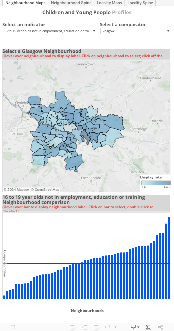
Interactive Children and Young People’s Data
This interactive tool allows you to view an extended set of children’s indicators for Glasgow’s neighbourhoods and sectors. You can use the menu tabs above to flip between map and spine chart views and between neighbourhood data and sector data.
Please note this interactive tool does not currently work with Internet Explorer and we are working to resolve this issue.